Wednesday, December 17, 2008


Trip report - Camping on Blue Ridge 12-12-08

The nice thing about camping in the inner Coast Range in the winter is that, well...you can actually camp in the winter. I love it. Sure, it's a little cold, but with a mylar tube tent (lightweight), mylar blanket, and sleeping bag, you can easily stay warm in 30 to 40 degree farenheight weather.

We were scouting an easement route for a new trail which will allow hiking up to Berryessa Peak. While it will take a couple years to get the trail completed and open, we need to start now by identifying the route before beginning the process to build it. So, this was the first trip.

The trip was pretty easy at the beginning, but the final hundred feet to the ridge was pretty steep with lots of chemise to bust through. The area had burned in the 2003 Rumsey fire so at least the brush was short. Once at the top, we continued south until we reached a nice clearing to set up camp. At that point we began scouting the easement route.

After finishing, we got dinner going, started a nice campfire, and enjoyed the sunset over Lake Berryessa. This is why we work so hard to protect the region.
You can see more photos from the trip, here.


Andrew Fulks

Monday, December 08, 2008

Congressman Mike Thompson Should Be Secretary Of Interior

Mike Thompson is my Congressman. He became my Congressman when Davis was added to District 1, but his environmental record is what makes him MY Congressman, regardless of in what District I happen to live in the future. I guess that makes him my Congressman-for-life. Why? Because Mike fought for the Cache Creek Wilderness.

The Cache Creek Wilderness is one of my most favorite places on Earth. It's no understatement. It's fantastic and Mike protected it. He fought hard for it, he battled Richard Pombo to get a hearing in committee so it could get moved to the House to get voted on. He got the bill protecting Cache Creek signed by President Bush, which is no small feat considering Bush's dismal record on Wilderness issues. He spent years pushing the bill through, with a tireless resolve.

He's a hunter. He camps. He backpacks. So does his family. He knows what it means to be on the land, to be part of the land, and how to protect the land. He's smart, pragmatic, and gets things done.

Mike has given me, my children, and all those that come after us the greatest gift you can imagine; protected wild land for us to enjoy in perpetuity. That's the kind of person we need at the Interior Department.

He's my Congressman. He should be Secretary of Interior.

Protected, thanks to Mike!

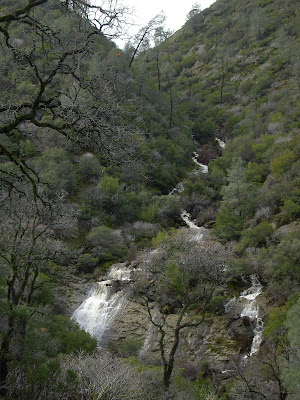
Falls on Trout Creek, protected, thanks to Mike!

Andrew Fulks

Saturday, July 12, 2008

Video Clips of Cache Creek Kayaking and Wildlife

The last few seasons of adventure down the Cache Creek Wilderness kayak run have left me with some nice video clips. The first is running a rapid in the middle of the wilderness (with 'helpful' assistants willing to drench said boater).
The second is of a Killdeer egg hatching. This was pretty cool, since we just happened to land on the sandbar right when the egg started to hatch. Once it was hatched, we launched and let momma bird take over. She wasn't happy with us, but this was a once-in-a-lifetime event. Very random, but very cool...


Andrew Fulks

Thursday, May 15, 2008

Review of the Blastmatch Fire Starter

I'd been looking for a waterproof fire starter. While I already had a butane lighter, but needed something while boating. The Blastmatch was attractive for a couple reasons. First, it contained the flint inside a plastic housing that was integrated with the striker. Second, you use a single hand to ignite your tinder. This is nice, because if you have to shield your tinder from the wind, or you need to hold a bear at bay while you light a signal fire...you know, your average outing.

While I didn't make the below video, it demostrates the product very well. I'd recommend it.

Andrew Fulks

Wednesday, April 23, 2008


4-12-08 Lynch Canyon to High Bridge Trail Hike


A large group went out to the Cache Creek Natural Area, to hike on the Bear Creek Unit. I'd wanted to do a through-hike, but a little shorter than what we had done the past few hikes. After looking over the trail map, I'd decided on a 7-mile hike down Lynch Canyon, past the Roadkill Cafe, and up and out via the High Bridge Trail.

The weather was great. The wildflowers were not as great as they have been in previous years, perhaps as as a result of the dry weather. They seem to be hard to time for each location, especially when they seem so good in other parts of the mountains.

But still, these are great mountains, and the day was perfect.

Andrew Fulks

Wednesday, March 12, 2008


Trip Report - 3-8-08 Zim Zim Falls Hike

Last year, I didn't get to enjoy this hike. It wasn't due to my lack of wanting to, but due to lack of rain. Zim Zim falls, located in the Napa Ranch addition to the Knoxville State Wildlife Area north of Lake Berryessa, is entirely fed by rain run-off. It was purchased by the Department of Fish and Game, with help from other non-profit and State agencies. For a history of the Zim Zim name, click here, and scroll to the bottom of the page to 'Zem Zem'.
This vast landscape is wonderful. Ok, so I'll win the award for oversimplification for that statement. Let's try again.

I like the subtlety of the Zim Zim valley. I think it's that subtlety that makes the falls so impressive. For the first 3.5 miles of the hike, you walk up a valley, following and crossing Zim Zim creek. The ridges on each side aren't terribly high, so it isn't like you are walking up some spectacular canyon, knowing you will ultimately meet a fabulous waterfall. No, you just gently wind up the valley, passing through blue oak woodlands. The falls are hidden around a bend in the river, so you have to climb up the hill (on a path of course) in order to view them.

After we had lunch on a rock outcropping overlooking the falls, we took the trail up behind the falls and climbed onto the western ridge above Zim Zim valley. From the ridge, we could see down onto Zim Zim and Nevada creeks, epic views of Lake Berryessa, and a fantastic panorama of Blue Ridge.

Great weather, great people, great place. More photos are posted here.


Andrew Fulks

Monday, March 03, 2008


Gear Review - Zodi Outback Portable Hot Shower

Granted, this is a total luxury. But, if you are car-camping with your family for more than a day, and you have kids that think dirt is the best playground ever invented, this thing is for you.

There are several models of this heater available. Some have dual burners, a soft case instead of a hard case, and some are industrial in size to use a larger propane tank.

Prices vary as well, but a basic model at Wal Mart is about $100. You can also find the occasional used model (as I did) on Ebay for about half that.
So, how does it work? It is actually so simple that I'm surprised it hasn't been made before. It's just a propane burner, with a copper coil wrapped around it. A small 6v pump pushes water through the coils, heating it before it comes out the shower head. If you want the water to be hotter, just put the shower head into the water source and let it cycle through again. The container that holds everything also doubles as a water source and stand for the propane container.
This is a really great product. Made in the USA, and built rock-solid. The body is all metal, and the pump, battery case, and container/water box are all very rugged. If you car camp and want the luxury of a hot shower, this is the gear for you.

Andrew Fulks

Wednesday, February 13, 2008


2-10-08 Walker Ridge Trip Report


I love California. I love being able to hike in early February, in shorts and short sleeves. Incredible.

So we went to Walker Ridge, which is a remote ridge on the border of Colusa and Lake Counties. It gets some use by off-road motorcycles, but the area is otherwise very lightly visited. It has some amazing vistas, and on a clear day you can see the Sutter Buttes and dthe Sierra Nevada. On this hike, we saw the Sierra very clear, but an inversion layer trapped all the valley smog/smoke/fog and obscured the Buttes.

The views of Snow Mountain were pretty fabulous, and the mountain lived up to it's name. We started off the hike with great views of the snow-capped peaks. We start at the highest point of the hike, so downhill we went toward Signal Rock. Along the way, we looked at an old chimney from a long-forgotten homestead. With mining, came the houses. When mining left, the harsh landscape left nothing else for the residents of the Sulphur Creek mining area. Only Wilbur Hot Springs remains in the watershed. From work to leisure, human uses of the region have changed greatly in 150 years.

This hike was a loop, looking at two large rock formations and the old Clyde mine. I've done this loop for many years now, and each time I am more astounded at the landscape. An entire pygmy forest of cedars, a grove of oaks in a sea of chemise, serpentine slabs with emerald green gloss and white veins.

I posted pictures on the images section of the Yolohiker website.


Andrew Fulks

Tuesday, January 29, 2008

Gear Review - Ka-bar hobo classic knife combo

I'd been wanting an all-in-one knife/fork/spoon combo for a while. I used to have a cheap plastic one when I was a kid, so I got to thinking about how I'd like one when camping now. So, I started searching around online for something. A few companies make different kinds, and Ka-bar makes several 'hobo' versions. The classic version is the best, in my opinion. It comes apart, so you can use the fork, knife, and spoon separately. There is another version that does not detach each item, but in my opinion, it's best to be able to use each utensil separately.

I found mine for a good price on ebay. It comes with a sheath, and is stainless steel. A great way to replace all your separate eating utensils.
Andrew Fulks

Saturday, January 26, 2008

1-26-08 Trip Report, Pierce Canyon Falls, Road 53

I had planned on leading a hike up to the Otis Ranch today, but the weather had been so bad the night before, Road 16 was closed at Rumsey. This would have meant we would have had to hike a few extra miles. Ordinarily that's not a problem, but while standing there in the Post Office parking lot in Guinda, we realized this would be the perfect time to hike Road 53, to see the falls. We guessed they must be running, and were they ever!


On the way up, there were still patches of snow. The snow had been so heavy, numerous tree branches had broken off, under the weight.


On the drive to the trailhead, Road 31, among others, was flooded.


The creek on the hike up was roaring.


The falls looked great. Lots of flow.


A wider view of the falls, with the side channel on the right.


Video of the falls.

Andrew Fulks

Tuesday, January 22, 2008

Snow in the Yolo Mountains

Oh, boy, I wish I wasn't working and could have gone up to Rumsey or the Ireland Ranch. I was doing work near Winters, and stopped to take these shots. There must have been at least 6 inches in the mountains further up towards Rumsey...(BTW, I was using a high zoom to get this close).


Andrew Fulks

Sunday, January 13, 2008


Otis Ranch Hike Map Now Up

I've added Yolo County's Otis Ranch hike to the trails available on the website. It's a great hike with views of the Capay Valley and Rumsey. The Capay Valley Hiking Club will be doing this hike on January 26th.

Andrew Fulks

Sunday, January 06, 2008

Rain Means Waterfalls

I could have done without the power outages and general landscaping damage, but it was nice to have some rain to replenish the creeks. When we get enough rain that it starts to run off the hills, we can enjoy visits to two of our local waterfalls.

The first is the Zim Zim falls, in Napa County on DFG's Napa Ranch. This waterfall is over 100-feet high, and roars between a notch of rock into the Zim Zim valley. Last year's meager rainfall didn't get this waterfall really going, so I'm hoping for better things this year. This fall drains a large valley, so if it gets going, it usually lasts through spring as a pretty big flow.


The second is the Pierce Canyon falls, in Yolo County. This waterfall is viewable from a public dirt road (Road 53) that leads out of Guinda, and only runs once Casey Flats begins draining water. This fall is best after a heavy storm, so be sure to time your hike accordingly. I've seen it roaring and I've seen it as a trickle. Dave Pratt has the best photo of it, which I've posted below. He loves this hike and is great about timing it.