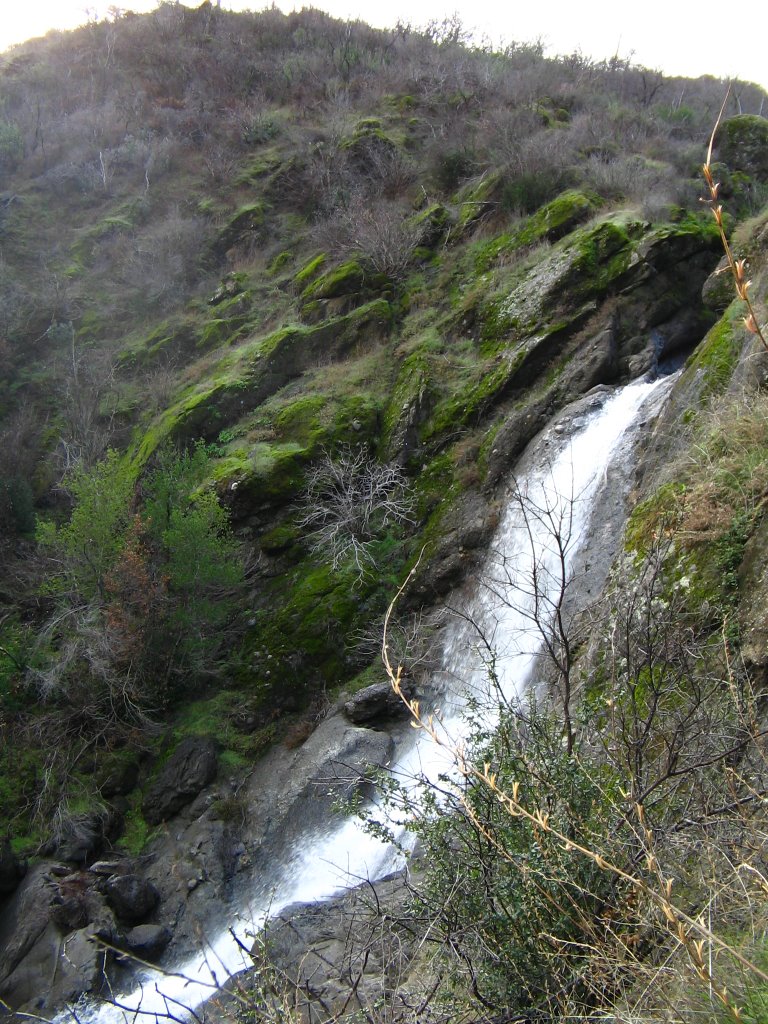
Upcoming trip to Zim Zim fallsApril 9th, the hiking club is going to Zim Zim falls on the newly-public Napa Ranch, above Lake Berryessa. This will be the first time with the club, and the second time for me. You know, it's real satisfying to know this 12,575-acre ranch is now in the public domain. Not only is it a wonderful property, it connects more property along the blue ridge mountains. I look forward to exploring every square inch of this area. There are lots of cool spots back there, as well as nice spur ridges and knolls. Plus we can now hike portions of the old toll road, that used to lead from Moticello to the Capay valley. The falls are pretty spectacular. Getting this open to the public was a real coup. So enjoy it and come out with us on April 9th. (But be prepared for wet feet, since you have to cross Zim Zim creek 8 times...)
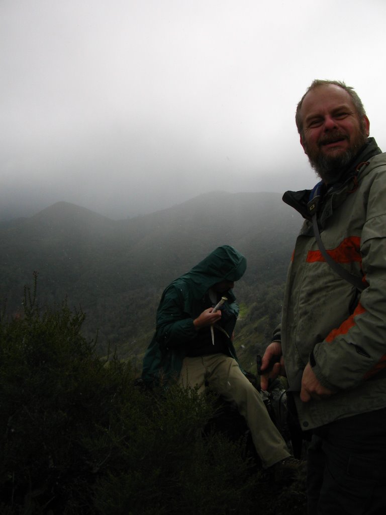
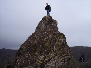
Walker Ridge Trip Report 3-12-06 So the last trip I took was to Walker Ridge. The forecast called for rain, but since we never cancel, and since I was leading the hike, I got up to go. A new hiker, Paul, was meeting me for a ride, so that was some incentive. Another friend, Trevor, wimped-out (yes, totally wimped-out to stay at home and bake banana bread with his girlfriend, COME ON!) so it was just Paul and I. I've found people come on these hikes based on weather, whereas I'm just happy to be able to get out and have the time to do it, so I'll never cancel unless really ill, and even then have been known to do 7 miles (and suffer for it later). As expected, we only had three others at the meeting location in Guinda, so we caravanned up to Walker ridge, off highway 20. The hike is one that I'd initially taken last year, by piecing together a route from topo maps and aerial photos. Not all of the route is shown on the topos, but two segments of trail were shown to connect on the aerial, so I took a chance. Walker Ridge is one of those places I have not explored as much as I want to. Part of the reason is time, and the other part is distance. The first reason is best, since the distance isn't that much greater than other hikes in the region, even though it is hard to not stop the car at the closest hikes, just to get going. The trail route is hard to find. Like most of the hikes in the region, there are no signs, so you have to know the landmarks and the area in general. We pulled out at the intersection between walker ridge road and the road to Indian valley reservoir then started the hike. Now, I'm going to purposefully omit a couple of the places we went to. There are some natural and cultural features I know about that if I wrote too much about, would end up getting trashed. So those get left out, but rest assured, there are enough great places to see without getting the full scoop. You want to find the obscure places, you need to explore like I have. So, the first stop was signal rock. Signal rock is shown on USGS maps, above the freshwater branch of Sulphur creek. I've read in old mineralogist’s reports that these rocks could be remnants of mineral deposits, exposed when the surrounding rock was eroded way. Signal rock is about 20-feet high, and I climbed as usual to the top. My camera decided to leave early, and bounced down. It was interesting to shout "uh, oh!" Then watch as the camera bounced end over end, but took so long that I was able to continue...'here it comes', 'oops', and ' make sure you catch it' (to Paul waiting below) I was certain it would be destroyed, but it was no worse for wear (minus a few dents). I’ve taken to buying inexpensive Canon digital cameras, since I have a history of destroying them on these adventures. They either drown on the river or tumble off rocks.... Anyway, one thing I didn’t mention is that it wasn't raining on us, despite the heavy rain in the valley. No, it was snowing. I love it when it snows on Walker ridge. This time, the snow was light and fluffy, like walking through a room filled with chicken feathers. We ate lunch behind the rock, with the snow blowing around us. Surprisingly, it really didn't feel cold. After lunch, it was time to head out to Eagle rock and then back up to the cars via Oak cove. Eagle rock is a similar spire to Signal rock, but in this case, we just look at it from an unnamed rock formation across the canyon. Getting to Eagle rock would require quite a bit of elevation loss, then bushwhacking to get to the rock itself. Not this time. Having seen Eagle rock, we backtracked a little ways until we got the intersection that took us to oak cove. Oak cove is a hidden oasis in a sea of chemise chaparral and pygmy cypress. It has oaks that inhabit the small grassland area with a seasonal creek that runs through the middle. I first spotted it on a map, and it was a nice hidden area. Sometime I need to return to look for signs Native American inhabitation. Usually when you have oak woodlands in secluded openings, or the confluence of two creeks or rivers, you find signs of settlement. Sometimes, but not always. After passing through Oak cove, we began our ascent back up to Walker ridge road. The old track is pretty eroded, with extremely deep ruts in the trail. Water flowed down the center of the trail, eroding 3-foot deep chasms. Near the road, we stopped at the Clyde mine to look at the adits. Clyde mine has a number of adits (tunnels going straight back into the mountain) as well as surface excavations. We also saw an old drop for ore carts. Satisfied at our discoveries, we headed back up the road to the cars. After we were done, we headed into Williams, off I-5, to stop at Granzellas to eat garlic-stuffed olives and marinated garlic. The rain was pouring down in the valley, but we had memories of the snow.

 Great site for creating GPS maps
I'd been pondering buying some sort of mapping software. At least, something better than Garmin's Mapsource software. Mapsource is fine, but I wanted something with topo maps in the background. I'd considered shelling out the $99 for National Geographic's Topo! software, which is really good.
Then, I stumbled across www.gpsvisualizer.com and was hooked.
This site lets you not only create maps online, for free, it lets you choose any number of backgrounds for the maps, including aerial photos and satellite images.
Several of my hikes, including the Knoxville State Wildlife Area, as well as Zim Zim falls and Road 53, have used this to create the maps. Not too shabby!